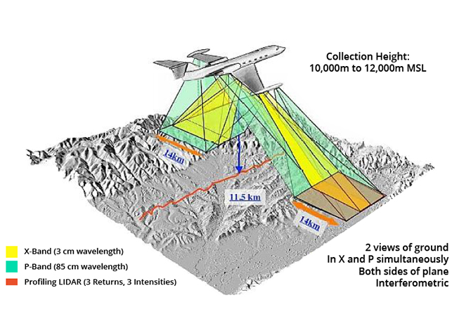
The Geographic Synthetic Aperture Radar (GeoSAR) program was an airborne radar-based project for simultaneously mapping foliage canopies along with the terrain underneath the canopies. Begun in 1996, the program outfitted a commercial Gulfstream II business jet with a dual-band (P-band and X-band), dual-sided, interferometric mapping radar, designed to efficiently map wide-areas in a single pass of the aircraft.
The goal of the program was to develop a radar-mapping technology that would provide both military and civilian users with elevation models of terrain in areas where foliage would otherwise cloak the terrain. Under sponsorship of DARPA and the National Geospatial Intelligence Agency (NGA), GeoSAR was developed jointly by NASAs Jet Propulsion Laboratory (JPL) and a commercial mapping company, Fugro Earth Data.